- Reclamation
- Upper Colorado Region
- CRSP
- Aspinall Unit
- Crystal Dam
- Blue Mesa Dam
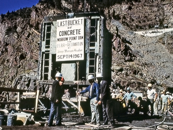
- Morrow Point Dam
The flows of the Gunnison River have always been a challenge since early settlers arrived in western Colorado. Low-lying valleys were often ravaged by spring floods, then by late summer, when irrigation was desperately needed it dwindled to a small stream. With the rapid settlement in the Uncompahgre Valley, farmers moved into the valley to capitalize on the opportunity to provide the necessary food supply for the mining industry. Irrigation began about 1875 to grow crops including the first crop of hay which was shipped to mines in southwestern Colorado. As early as 1890, settlement and agricultural needs expanded such that additional water supplies became necessary. Soon, active support was sought for driving a tunnel from Gunnison River to the Uncompahgre Valley to deliver additional water.
Construction of the Gunnison Tunnel began in 1905 and was completed in 1912 to divert water from the Gunnison River for irrigation needs. Initially called the Gunnison Project, it was later renamed to the Uncompahgre Project.
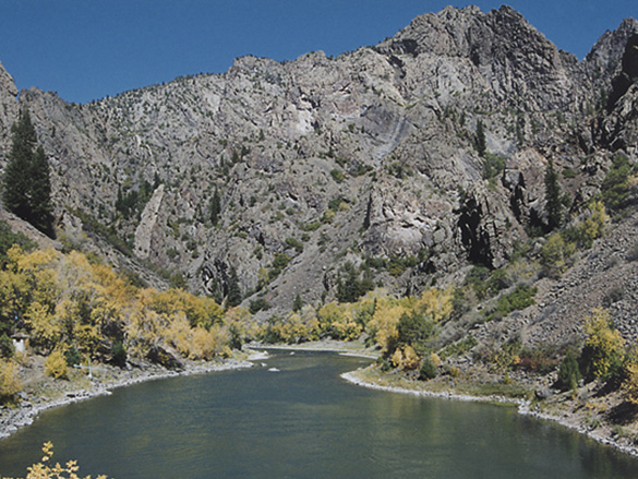
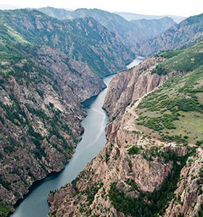
The Wayne N. Aspinall Unit on the Gunnison River was authorized as part of the Colorado Storage Project Act on April 11, 1956, as one of the four initial Colorado River Storage Project units and overlays part of the Uncompahgre Project. The Gunnison River, which originates in west central Colorado, is formed by the confluence of the Taylor and East rivers and is the fifth largest tributary of the Colorado River. Together, Blue Mesa Dam, Morrow Point Dam, and Crystal Dam developed the water storage and hydroelectric power generating potential along a 40-mile section of the Gunnison River while also regulating the flow of the river and in turn, assisting in the regulation the Colorado River. The three Aspinall Unit dams are located in the upper part of the Black Canyon of the Gunnison, one of the longest, narrowest, and deepest gorges in the world.
Originally named the Curecanti Unit, the name was changed in 1980 to honor U.S. Representative Wayne N. Aspinall from Colorado, a strong proponent of water resources development in Colorado and the western states. He served 24 years in the House of Representatives and was instrumental in the passage of the Colorado River Storage Project Act.
Related Resources
Colorado River Storage Project
The Uncompahgre Project
Curecanti National Recreation Area
Black Canyon of the Gunnison
Looking for water data? WATER OPERATIONS
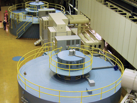
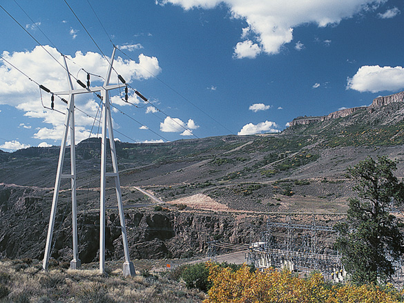
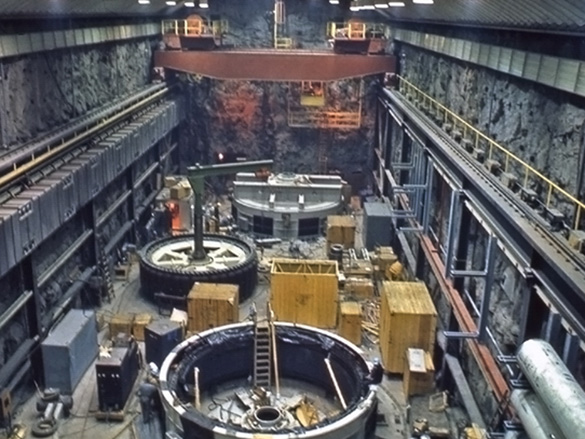
The capacity of the generating units in each of the Aspinall powerplants has been increased from the original capacity through the application of new technology and other work performed in the powerplants as repair or replacement of equipment occurred due to normal “wear and tear” and aging. The current combined nameplate capacity of the generating units in each powerplant is listed in the table below as well as the average annual generation.
| Facility | Construction Completion Date | Number of Generating Units | Capacity (megawatts) | Average Annual Generation (kilowatt hours) |
| Blue Mesa Powerplant | 1967 | 2 | 86.4 | 264,329,000 (1968-2006) |
| Morrow Point Powerplant | 1971 | 2 | 173.3 | 343,450,000 (1971 - 2006) |
| Crystal Powerplant | 1978 | 1 | 31.5 | 167,771,000 (1978 - 2006) |
The initial operation of the Aspinall Unit focused on maximizing water storage, hydropower production, releases for water rights and agreements, and reducing flow variations in the Gunnison River below Crystal Dam. Primary water storage occurs in the uppermost and largest reservoir, Blue Mesa. Blue Mesa and Morrow Point Powerplants are operated primarily as peaking powerplants and Crystal Powerplant is generally base loaded to moderate downstream flows.
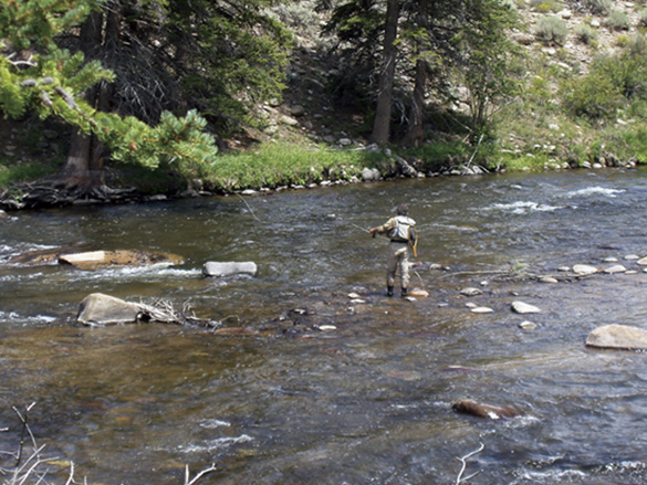
When Blue Mesa dam began operating in 1966, a minimum downstream flow of 100 cubic foot-per-second (c.f.s.) was established for the Gunnison River. The minimum was increased to 200 c.f.s. in 1976 as Crystal Dam was nearing completion. In 1985, based on studies to protect the Gold Medal trout fishery that had developed downstream of the Aspinall Unit, the minimum release was raised to 300 c.f.s. except for extreme drought, operational emergencies or other qualifying circumstances.
The Aspinall Unit was authorized and constructed upstream of the Black Canyon of the Gunnison which was designated the Black Canyon of the Gunnison Nation Monument (National Monument) in 1933 and given an un-quantified reserved water right. In 1982, this reserved water right was upheld and ordered for quantification by the Colorado Supreme Court. The National Monument became the Black Canyon of the Gunnison National Park in 1999. Although there have been efforts to reach agreement on the water right and its use, the matter remains unresolved. The magnitude of the reserved water right has the potential to significantly affect the Aspinall Unit's operation and ability to meet the authorized purposes and could also affect water users in the Gunnison River Basin.
Endangered fish are found in the lower Gunnison River approximately 50 miles downstream of the Aspinall Unit reservoirs. The endangered fish habitats are being studied to help identify reservoir releases and other measures to benefit the endangered fish species. A Record of Decision for the Aspinall Unit Operations Environmental Impact Statement was signed on May 3, 2012. The EIS modified the operational objectives of the Aspinall Unit to provide sufficient releases of water at times, quantities, and durations necessary to avoid jeopardy to endangered fish species and adverse modification of their designated critical habitat while maintaining and continuing to meet authorized purposes of the Aspinall Unit. In addition, the water right for the Black Canyon of the Gunnison National Park has been quantified and adjudicated.
The Aspinall Unit Working Group, formed to provide an open forum for information exchange on the operation of the Aspinall Unit, meets three times a year. Participants include Reclamation, other government agencies and public and special interest groups.
Related Resources
Aspinall Unit Operational Data
Blue Mesa Dam Project Data
Crystal Dam Project Data
Morrow Point Dam Project Data
The Uncompahgre Project
Colorado River Storage Project
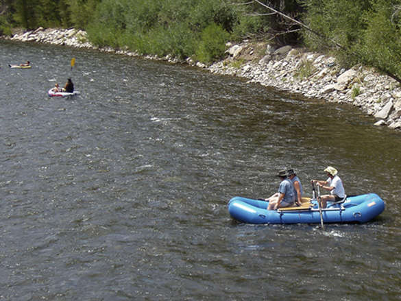
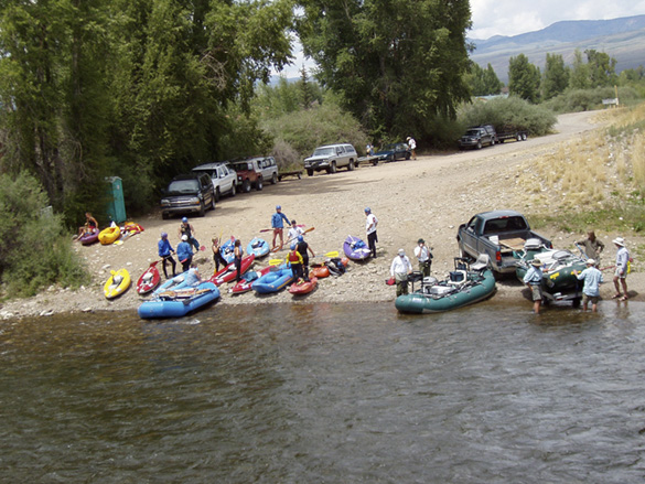
 Upon completion of Blue Mesa Dam in 1965, Blue Mesa Reservoir began filling and soon became the largest body of water in Colorado. Blue Mesa Reservoir rapidly developed into a premier coldwater fishery for kokanee salmon and rainbow trout. After the later completion of Morrow Point Dam and Crystal Dam downstream, water began filling the narrow, rocky canyons forming Morrow Point Reservoir and Crystal Reservoir. Although Morrow Point and Crystal Reservoirs are difficult to access, the sheer cliffs surrounding these reseroirs provide unparalleled scenery. Nearly one million visitors enjoy the water-based recreation available at the Aspinall Unit reservoirs each year.
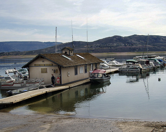
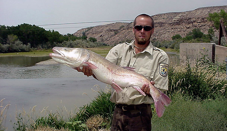
The Gunnison River downstream of the Aspinall Unit dams, has developed into a gold medal quality trout fishery due to the stable releases of cold water from deep in the reservoirs. Reclamation has acquired public fishing easements on the Gunnison River and Lake Fork of the Gunnison River to help replace stream fishing inundated by the reservoirs. The Gunnison and Cimarron State Wildlife areas were acquired and developed as the Aspinall Unit was constructed, to replace wildlife habitat lost with the filling of the reservoirs.
The endangered Colorado pikeminnow and razorback sucker are found in the lower portions of the Gunnison River 50 miles (approximately 80 kilometers) downstream of the reservoirs, and in the Colorado River where the temperatures have warmed. Endangered fish habitats are being studied as part of the Upper Colorado River Endangered Fish Recovery Program (Recovery Program) to determine reservoir releases that will benefit these species. The Recovery Program was established in 1988 as a coalition of federal, state and private organizations and agencies in Colorado, Utah and Wyoming, to recover the endangered Colorado River Basin fish while allowing for future water development for agricultural, hydroelectric and municipal uses.
Related Resources
Blue Mesa Dam Project Data
Crystal Dam Project Data
Morrow Point Dam Project Data
The Uncompahgre Project
Colorado River Storage Project
Since 1965, the Aspinall Unit lands have been managed by the National Park Service as the Curecanti National Recreation Area (NRA), although Congress has not designated the area as such. The National Park Service and Reclamation are currently preparing a joint recommendation to Congress that includes designation of the area as the Curecanti National Recreation Area.
The NRA encompasses approximately 41,972 acres surrounding the three Aspinall Unit reservoirs on the Gunnison River and borders the Black Canyon of the Gunnison National Park on the west. The NRA was established to provide for conservation of the scenic, natural, historic, archeological, and wildlife values of this area while providing for public use and enjoyment.
Unique aspects of the Curecanti NRA include the recent discovery of dinosaur fossils, a 5,000 acre archeological district, and traces of 6,000 year-old dwellings representing some of the oldest villages found in North America. Approximately one million visitors a year enjoy the scenery and recreation activities available in the NRA which include camping, hiking, fishing, hunting, sight-seeing, and water-based activities.
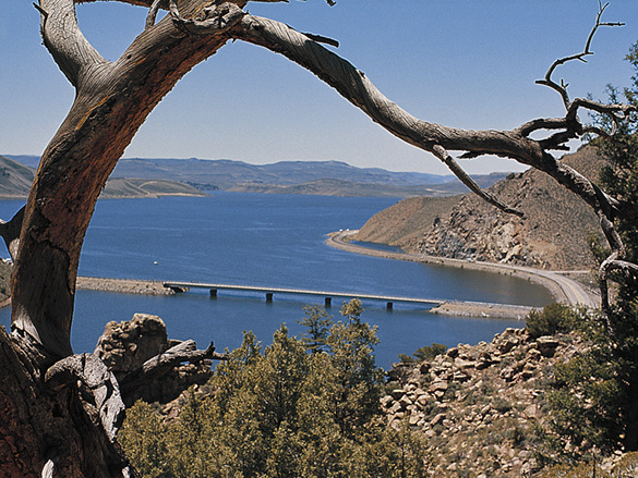
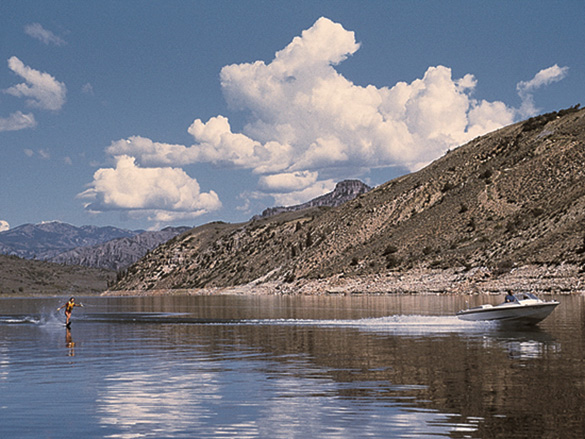
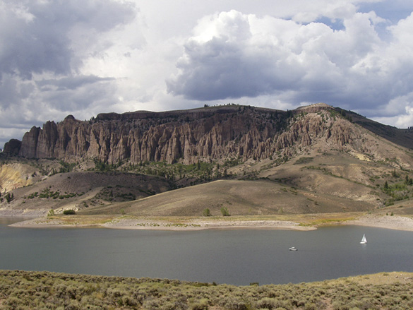
The unique character of each of the three Aspinall Unit reservoirs provides visitors a different boating experience. Twenty mile-long Blue Mesa Reservoir is the largest body of water in Colorado and one of the largest high-altitude bodies of water in the United States. It is also home to the largest kokanee salmon fishery in the United States. The three open basins, and several arms of Blue Mesa Reservoir, provide a diverse range of water recreation opportunities including sailboating, windsurfing, water skiing, and cold-water fishing. The Soap Creek, Cebolla, and Lake Fork arms offer visitors a wonderful remote boating experience.
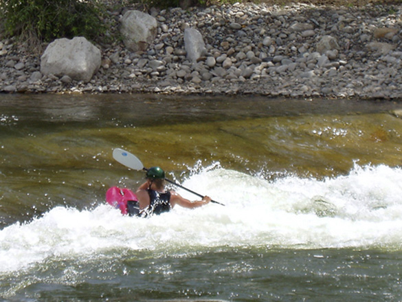
The high-quality trout fishing and unique canyon environment found at Morrow Point and Crystal Reservoirs draw fishing enthusiasts from across the country. Morrow Point Reservoir is a popular location for canoeing and kayaking because of the spectacular canyon scenery and the journey which begins swiftly for the first half-mile and then becomes still and calm for the remaining 11.5 miles. Only hand carried water craft can be used on these two reservoirs because of limited access via canyon trails. The Pine Creek Trail leads visitors to the upper end of Morrow Point Reservoir and the upper end of Crystal Reservoir can be reached via Mesa Creek Trail located near Cimarron.
The National Park Service offers a 1.5 hour round trip pontoon boat tour beginning at Morrow Point through the upper Black Canyon of the Gunnison, guided by a park ranger. Up to 42 passengers can be accommodated on the tour which begins at the Pine Creek boat dock.
Related Resources
Curecanti National Recreation Area
Black Canyon of the Gunnison
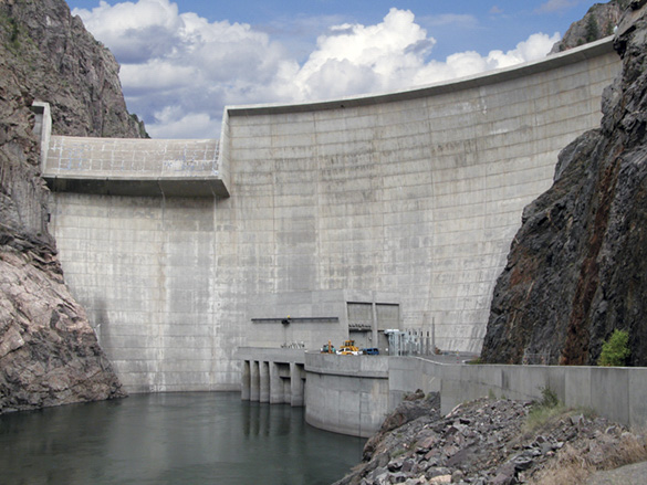
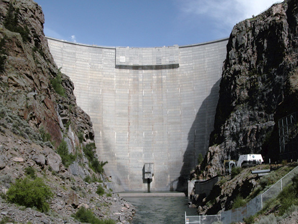
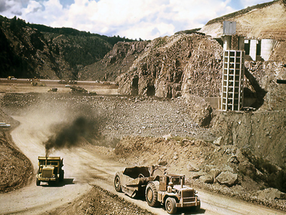
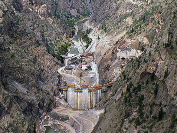
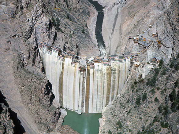
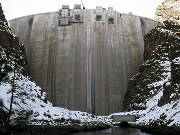
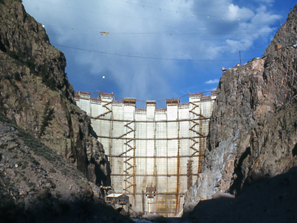
 Construction on Crystal Dam began in mid-1973 and continued through August 1976 when the dam was topped out. Crystal Dam is a double-curvature, thin-arch concrete structure and is located six miles downstream of Morrow Point Dam, and approximately two miles above the eastern boundary of the Black Canyon of the Gunnison National Park.
Crystal Dam serves an important function in stabilizing the flows of the Gunnison River to benefit the downstream environment, particularly the Black Canyon of the Gunnison National Park, as well as the production of hydroelectric power. Crystal Dam can be seen from the end of the East Portal road which begins just past the south rim entrance station at Black Canyon of the Gunnison National Park.
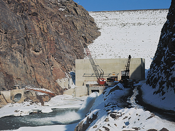
Crystal Dam stands 323 feet above the streambed, with a crest length of 635 feet and contains 154,400 cubic yards of concrete. Water from the reservoir is released through the turbines of the powerplant, but during flood periods when the reservoir level exceeds full pool at elevation 6,755, water can pass over the ungated spillway. Crystal Powerplant contains one generating unit with a total capacity of 32 megawatts.
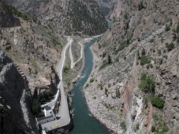
Crystal Reservoir extends six miles to Morrow Point Dam, and covers an area of about 340 acres. When Crystal Reservoir is full, it has a capacity of about 26,000 acre-feet. Just downstream from Crystal Dam is the Gunnison Tunnel, the historic diversion for the Uncompahgre Project. The Black Canyon of the Gunnison National Park is located immediately downstream from the tunnel, and stretches 14 miles along the Gunnison River.
Related Resources
Crystal Dam Project Data
The Uncompahgre Project
| Crystal Dam | |
| Location | Gunnison River, 6 miles downstream of Morrow Point Dam |
| Dam type | Double-curvature, thin-arch concrete |
| Construction period | 1973-1976 |
| Crest length | 635 feet (194 meters) |
| Structural height | 323 feet (98 meters) |
| Volume of concrete | 154,400 cubic yards (118,047 cubic meters) |
| Spillway type | Ungated ogee crest on right side of dam and plunge pool at toe |
| Powerplant | 1 generation unit, 32 megawatt capacity |
| Crystal Reservoir | |
| Reservoir length | 6 miles (9.7 kilometers) |
| Surface area when full | 340 acres (138 hectares) |
| Capacity when full | 26,000 acre-feet (32 million cubic meters) |
| Depth of water at dam when full | 227 feet (69.2 meters) |
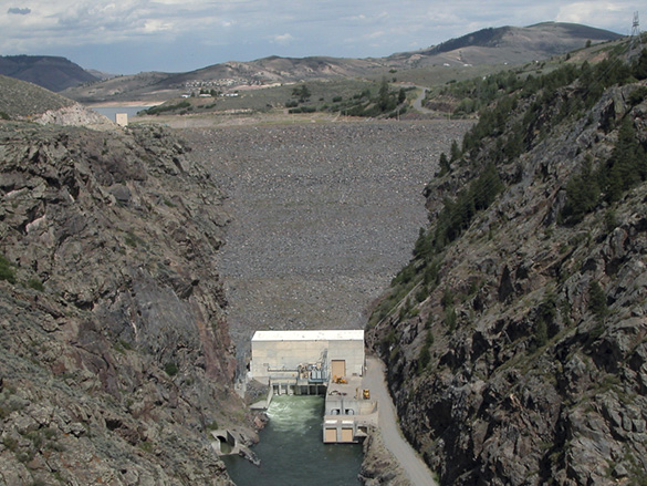
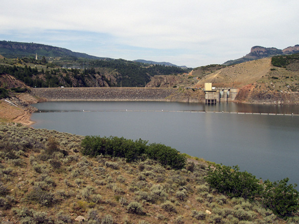
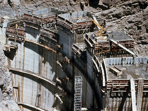
 Blue Mesa Dam, is located on the Gunnison River about 30 miles below Gunnison, and 1.5 miles below Sapinero, Colorado. Completed in 1966, the 390-foot tall [342 feet above streambed] zoned earth and rock-filled embankment is the uppermost dam on the Gunnison River. It contains three zones of selected rock, cobbles, sand, and clay totaling 3,093,000 cubic yards of materials and has a crest length of 785 feet. Blue Mesa Dam was the first to be built and is the largest of the three Aspinall Unit dams intended to store and control spring flows on the Gunnison River. Blue Mesa Reservoir is the largest body of water in Colorado stretching a distance of 20 miles with 96 miles of shoreline. When the reservoir is full at elevation 7,519 feet above sea level it has a total capacity of 940,800 acre-feet and a surface area of 9,180 acres.
Water is released from Blue Mesa Reservoir through large pipes called penstocks that extend through the dam and into the powerplant where the water turns turbines that generate electricity. Blue Mesa Powerplant contains two generating units with a total capacity of 86 megawatts. Additional water can be released through the outlet works and the spillway.
When potential dam sites were being investigated, cost studies indicated that it would be more economical to construct Blue Mesa Dam as an earthfill dam rather than a concrete dam. This resulted in a slight modification to the location the dam would be built at. It also had several additional benefits including reduced distance for hauling earthfill material, easier access to the powerplant, reduced embankment volumes, and better spillway alignment.
Related Resources
Blue Mesa Dam Project Data
The Uncompahgre Project
| Blue Mesa Dam | |
| Location | Gunnison River, 30 miles below Gunnison, CO Uppermost of the three dams |
| Dam type | Zoned earthfill embankment |
| Construction period | 1962-1966 |
| Crest length | 785 feet (239 meters) |
| Structural height | 390 feet (119 meters) |
| Volume of material | 3 million cubic yards (2.3 million cubic meters) |
| Spillway type | Concrete intake strcuture, concrete lined tunnel and flip bucket |
| Spillway Capacity | 34,000 cubic feet per second (254,320 gallons per second) |
| Powerplant | 2 generation units, 86 megawatt capacity |
| Blue Mesa Reservoir | |
| Reservoir length | 20 miles (32 kilometers) |
| Miles of shoreline | 96 miles (154 kilometers) |
| Surface area when full | 9,180 acres (3,715 hectares) |
| Capacity when full | 940,800 acre-feet (1,160 million cubic meters) |
| Depth of water at dam when full | 333 feet (101.5 meters) |
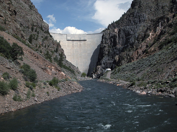
 Morrow Point Dam is located 12 miles downstream of Blue Mesa Dam in a steep and narrow reach of the Black Canyon. Completed in 1968, Morrow Point Dam was the first thin-arch, double curvature concrete dam built in the United States. Double-curvature means that the dam not only curves from left to right, it also curves from top to bottom. Morrow Point stands 468 feet high from the streambed, with a crest length of 724 feet, and contains 365,180 cubic yards of concrete.
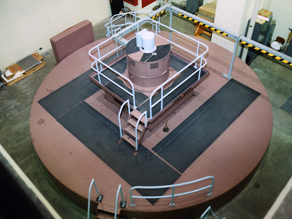
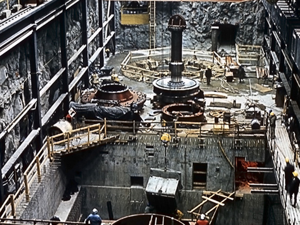
The primary purpose for Morrow Point Dam is to store water for hydroelectric power generation but it also provides for irrigation, limited recreation, and flood control by regulating the river. The powerplant at Morrow Point was the first powerplant constructed underground by Reclamation and is one of only a few in the United States. The powerplant chamber is tunneled into the canyon wall in the left abutment about 400 feet (122 meters) below the ground surface. Morrow Point Powerplant contains two generating units with a total capacity of 165 megawatts.
The reservoir behind Morrow Point Dam is formed between the narrow canyon walls and extends to the powerplant discharge point at Blue Mesa Dam. When full, Morrow Point Reservoir’s elevation is 7,160 feet (2,182 meters) above sea level and has a capacity of 117,190 acre-feet (145 million cubic meters) and a surface area of 817 acres (331 hectares). When the capacity of the penstocks and outlet pipes is exceeded, water from the reservoir can be released through the four spillway openings near the top of the dam and fall freely more than 350 feet (107 meters) to the stilling basin at the base of the dam.
Related Resources
Morrow Point Dam Project Data
The Uncompahgre Project
| Morrow Point Dam | |
| Location | Gunnison River, 12 miles downstream of Blue Mesa Dam |
| Dam type | Double-curvature, thin-arch concrete |
| Construction period | 1963-1968 |
| Crest length | 724 feet (220 meters) |
| Structural height | 468 feet (143 meters) |
| Volume of concrete | 365,180 cubic yards (279,200 cubic meters) |
| Spillway type | 4 orifice-type openings providing free-fall discharge |
| Spillway capacity | 41,000 cubic feet per second (306,701 gallons per second) |
| Powerplant | 2 generation units, 173 megawatt capacity |
| Morrow Point Reservoir | |
| Reservoir Length | 12 miles (19.3 kilometers) |
| Surface area when full | 817 acres (313 hectares) |
| Capacity when full | 117,190 acre-feet (145 million cubic meters) |
| Depth of water at dam when full | 413 feet (125.8 meters) |
